
Platform overview
Know your streets.
Explore traffic, parking and public transport across the city, and see how conditions change over time.
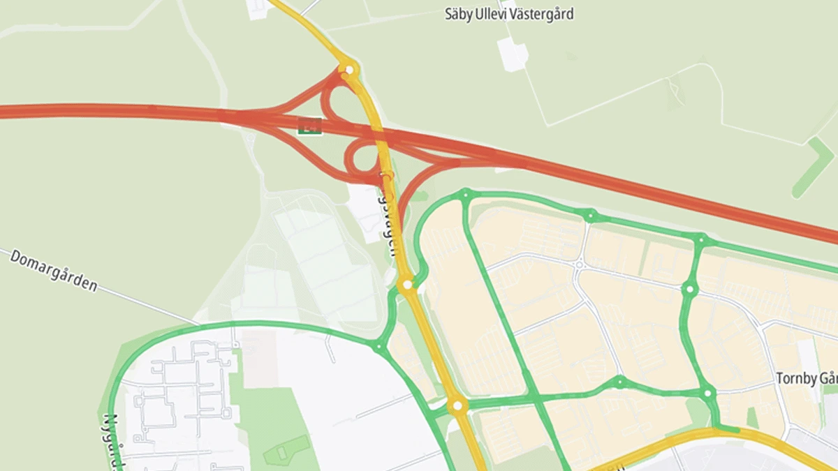
Traffic map
Speeds and congestion, weekday afternoon
Explore Citylytics
Start with what you work with.
Traffic
Understand volumes, speeds, congestion and change across the road network.
- Traffic volumes
- Speeds and speed compliance
- Congestion
- Traffic regulations
Parking
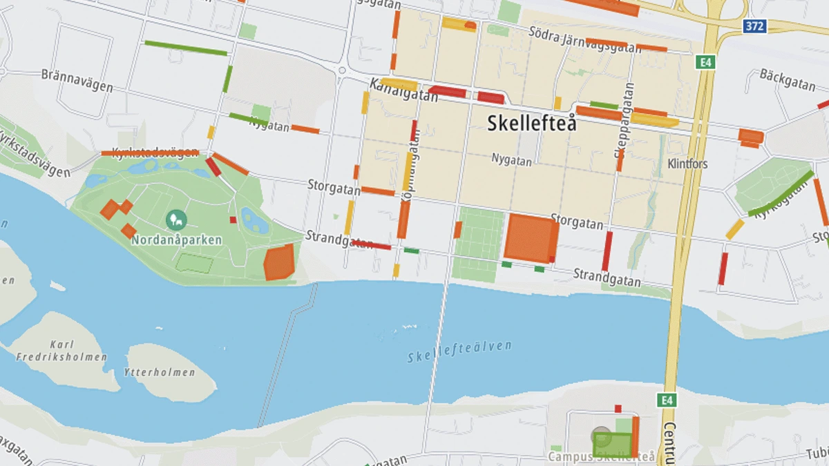
Understand occupancy, demand and capacity by street, zone and time.
- Occupancy and demand
- Capacity and inventory
- Patterns over time
- Parking regulations
Revenue & Compliance
Connect parking activity with payments, revenue and enforcement.
- Revenue by zone
- Revenue compared with demand
- Violations and compliance
- Enforcement activity
Public Transport
Get an independent view of how public transport performs across the city.
- Live network overview
- Historical analysis
- Delay hotspots
- Public transport accessibility
Analysis
See what changed, and where.
Compare streets, areas and time periods to see how conditions change and what happened after an intervention.
By place
Compare streets, zones or larger areas.
By time
Compare hours, days, seasons or longer periods.
Before and after
See what changed following an intervention.
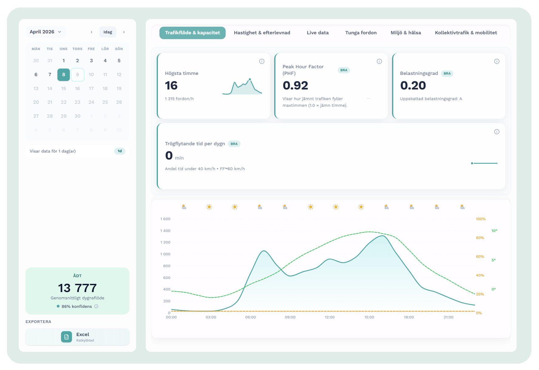
Traffic flow and capacity
One street, one day, hour by hour
Simulation
Test what happens next.
Explore traffic, parking and policy scenarios before making a change.
Traffic scenarios
A closed street, a new speed limit or a new development.
Parking scenarios
Changed capacity, new zones or different time limits.
Policy scenarios
Changed fees, rules or access, and how the effects spread across the area.
Scenario comparison
Today next to the scenario
API & Integrations
Bring Citylytics data into your own tools.
Access available Citylytics data directly through the API.
Request
GET /v1/parking/availability
    ?bbox=18.05,59.32,18.08,59.34
    &at=2026-04-08T08:00Z
Your product
Parking availability per street
Method
Built from 100+ data sources.
Our in house models turn open, licensed, geographic and customer provided data into street level estimates and analysis.
Inputs
Open and public dataData published by public authorities and open data sources.
Road networks, speed limits, traffic regulations, public transport feeds, population and land use data.
Licensed dataSpecialist datasets from commercial data providers.
Aggregated movement, speed, travel time, incident and vehicle data from traffic, navigation and mobility data providers.
Geographic dataSpatial context for streets, places and areas.
Street geometry, buildings, zones, land use and points of interest used to understand where activity takes place.
Customer-provided dataLocal data a city already has and chooses to add.
This can include traffic counts, parking inventory, payment records, enforcement data and other local operational datasets.
In-house models
- 01
Combine
Bring the sources together.
- 02
Calibrate
Adjust for local conditions.
- 03
Model
Turn the combined data into street level estimates.
Citylytics output
Street-level data and analysis
Every street segment, every hour
No sensors required.
Citylytics combines digital data sources and in house models instead of relying on street hardware.
See Citylytics in action.
We tailor the walkthrough to the questions and areas most relevant to your work.
Book a walkthrough
No preparation required. We tailor the walkthrough to your questions.